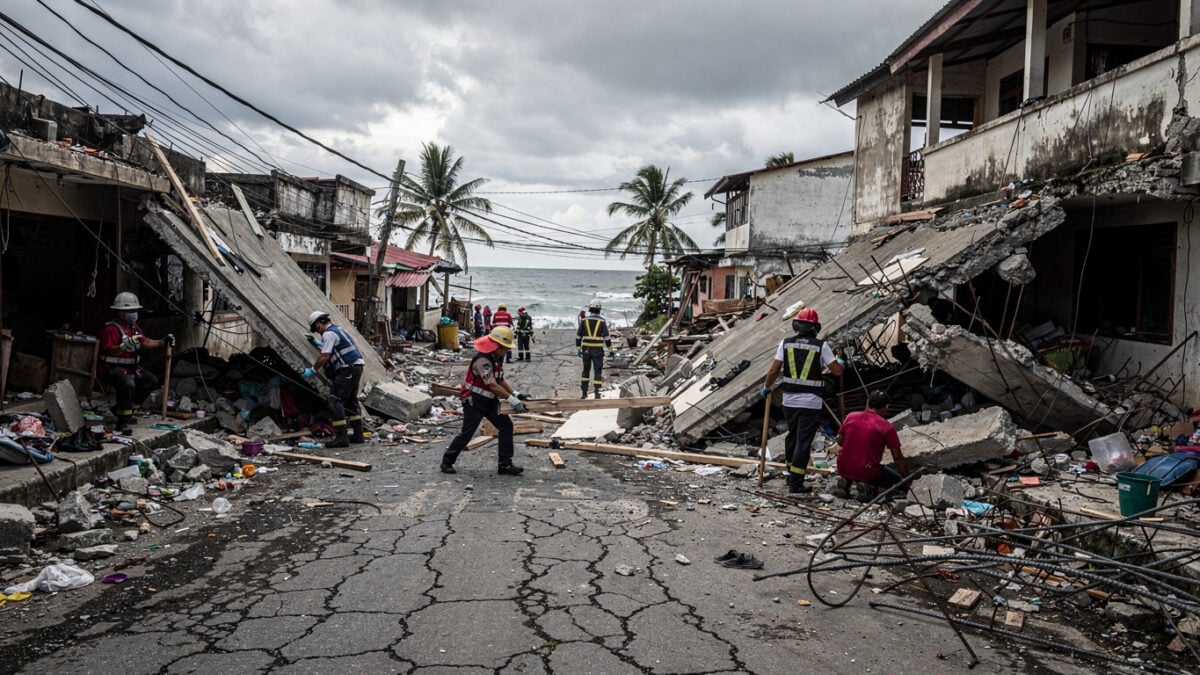
A magnitude 7.8 earthquake struck off the coast of Mindanao at 10:37 p.m. local time on June 8, 2026, the strongest to hit the Philippines since 1976. The National Disaster Risk Reduction and Management Council recorded 38 deaths, 473 injured and four missing by June 10. More than 32,000 people have left their homes, and over 18,000 of them now shelter in 215 evacuation centres across the Davao and Soccsksargen regions.
President Ferdinand Marcos Jr. has ordered agencies to protect hospital patients and speed up relief. The United States, Japan, France and New Zealand have all offered aid.
The quake hit at 10:37 p.m., when most of Mindanao was asleep. That timing shaped everything that followed. People were inside their homes when the shaking began, and the homes are now part of the casualty count.
PHIVOLCS measured the offshore rupture at magnitude 7.8, the largest in the Philippines in nearly five decades. The seismic energy was never the question. The question was whether the buildings, the roads and the response system built since the last quake of this size would hold.
By June 10, the answer was partial and still moving. Rescue teams had reached the coastal towns but not the remote inland barangays, where damage reports were thin and casualty figures provisional. The numbers the government published were not final. They were the numbers from the places rescuers could reach.
The toll is bounded by access, not by impact
The NDRRMC situational report on June 10 lists 38 confirmed deaths, 473 injured and four missing. It also counts 32,418 people displaced, drawn from about 6,780 families. Of those, 18,295 are housed in formal evacuation centres. The rest are staying with relatives or in the open.
Damage assessments remain preliminary. Officials reported 2,516 houses and 117 public facilities, including schools and local government buildings, as damaged across the affected provinces. These figures will rise. They are field tallies from accessible areas, not a completed survey.
Renato U. Solidum Jr., Secretary of the Department of Science and Technology and former PHIVOLCS director, said the large offshore quake reflects Mindanao’s position along a major subduction zone. He warned of strong aftershocks and urged strict adherence to building codes during reconstruction. Official seismic monitoring recorded hundreds of aftershocks above magnitude 3.0 in the 48 hours after the mainshock, a sign of active stress along the fault.
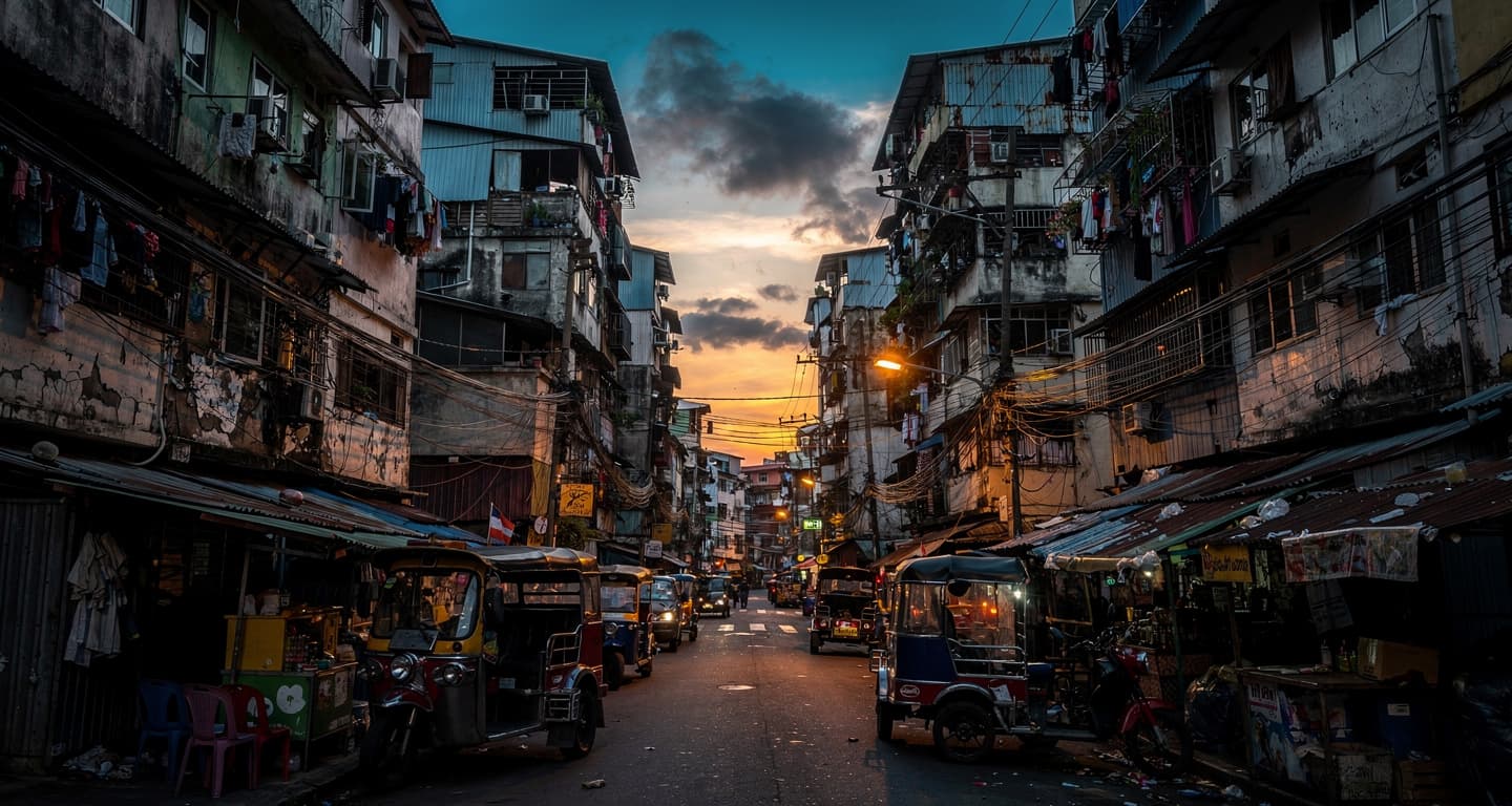
Here the causation runs in one direction. Mindanao’s coastal tourism and export farming, which serve Western visitors and consumers of tuna and coconut, have pushed resorts and plantations onto erosion-prone shorelines. Philippine planning studies have documented that expansion into subsiding ground. Western demand sustains construction in zones whose vulnerability the June 8 quake has now made visible.
The damage data are recorded under Republic Act No. 10121, the law that makes NDRRMC the lead disaster body. What that framework cannot yet show is how many of the 117 damaged public buildings failed because the code was weak, and how many because it was ignored.
The system that 1976 built is being tested
The comparison that matters is half a century old. On August 17, 1976, the Moro Gulf earthquake struck at an estimated magnitude 7.9, generating tsunamis that swept coastal Mindanao and the Sulu archipelago overnight. Official tallies later cited over 3,000 deaths and hundreds of thousands displaced.
That disaster exposed a near-total absence of early warning and codified building standards. It led directly to the creation of PHIVOLCS and to the disaster laws that frame the 2026 response. The gap between the two death tolls is the measure of what those institutions changed.
| Metric | Figure | Source | Date |
|---|---|---|---|
| Deaths, 1976 Moro Gulf | Over 3,000 | Philippine government tallies | Aug 17, 1976 |
| Deaths, 2026 Mindanao | 38 | NDRRMC | Jun 10, 2026 |
| Displaced, 1976 | Hundreds of thousands | Government tallies | Aug 1976 |
| Displaced, 2026 | 32,418 | NDRRMC | Jun 10, 2026 |
One detail from the official record cuts against the relief. The Department of Public Works and Highways has reported that only a minority of older bridges in the region have undergone full seismic retrofitting. The institutions that pulled the death toll down from 3,000 to 38 still rest on infrastructure built before they existed. That timing question — buildings asleep when the ground moved — is the one the next reports must answer.
Beyond the headline
The human cost
Behind the national totals are fishing families along Mindanao’s coasts whose boats, gear and homes were destroyed in a single night, cutting off shelter and income at once. Inland, patients evacuated from cracked rural clinics now receive care in crowded school-based centres, where disrupted water and sanitation raise infection risks even for those who survived the shaking unhurt.
The response gap
Smaller Mindanao municipalities often rely on thinly staffed disaster offices and volunteer responders, which limits rapid building assessments and the management of large evacuation sites. When roads and telecommunications fail, those constraints translate into slower aid and patchier protection for the most vulnerable, even as national agencies stress that the response architecture is adequate on paper.
The bigger picture
The country’s fast-growing secondary cities have sprawled faster than the enforcement of zoning rules and seismic design, especially in Mindanao. As economic activity pushes into coastal and hillside zones to serve global markets, more people and assets sit directly atop active faults, turning each major quake into a test of whether planning has kept pace with known risk.
What to do while the figures are still moving
With casualty and damage numbers expected to rise as rescuers reach remote areas, anyone connected to southern Philippines faces decisions now.
- Travellers heading to or through Mindanao
Check the latest NDRRMC advisories before booking or transiting, and cross-reference your own government’s travel advice for road, port and airport disruptions. The earthquake also triggered tsunami warnings across coastal areas, so confirm coastal route status separately.
- Families of nationals in the affected provinces
Review your embassy’s emergency registration page — for U.S. nationals, the U.S. Embassy in Manila operates the STEP system — to log location details, receive alerts and understand consular assistance if evacuation or replacement documents become necessary.
- Donors and aid organisations
Track whether foreign offers convert into deployed support. Aid from the United States, Japan, France and New Zealand depends on formal Philippine requests; watch for a national calamity declaration, which would accelerate procurement and the release of relief funds.
FAQ
Are airports and ferries in the affected region operating?
The Civil Aviation Authority of the Philippines issues real-time notices on runway inspections and structural checks after major earthquakes. Travellers should verify the status of General Santos, Davao and nearby airports through CAAP and airline channels. Maritime links may also be affected, as the Philippine Ports Authority can order safety inspections before ferries resume normal schedules.
How can foreign nationals get consular help in the affected provinces?
Embassies in Manila typically activate crisis hotlines and ask citizens in affected regions to register through systems such as the U.S. STEP portal or equivalent European state platforms. These enable targeted alerts, welfare checks and, in severe cases, coordination of assisted departures. Specific shelter or evacuation options vary by embassy and depend on local damage assessments.
Will travel or property insurance cover earthquake disruption?
Policies often treat earthquakes as a distinct peril, and some basic packages exclude seismic damage or trip disruption. Check whether your plan includes natural catastrophe clauses for the Philippines, confirm documentation requirements such as barangay or police reports, and note filing deadlines. No single authoritative source confirms standard terms, so verify directly with your insurer.
Explainer
- NDRRMC
- The National Disaster Risk Reduction and Management Council is the lead Philippine body for disaster preparedness, response and recovery. It was established under Republic Act No. 10121 in 2010 and coordinates national agencies and local governments during major hazards. Its situational reports are the official source for casualty and displacement figures, which it updates as rescue teams reach more areas.
- Republic Act No. 10121
- The Philippine Disaster Risk Reduction and Management Act of 2010, the law that created the NDRRMC. It mandates local government units to activate incident command systems during major hazards such as earthquakes. The law also defines the powers that flow from a declared state of calamity, including expanded procurement and the use of emergency funds.
- Moro Gulf earthquake
- A magnitude 7.9 earthquake that struck the southern Philippines on August 17, 1976. Its tsunamis killed over 3,000 people across coastal Mindanao and the Sulu archipelago, mostly at night. The disaster’s failures in warning and building standards directly prompted the creation of PHIVOLCS, the agency that measured the 2026 quake.
RELATED STORIES