Major weather centres in the United States, Europe and Australia are tracking the possibility of a strong — potentially “super” — El Niño forming across the equatorial Pacific in 2026–2027. What gives the warning weight is not the raw forecast probability but the baseline it would land on: the WMO outlook, summarised by United Nations University, puts a 70% chance that the 2025–2029 global average runs above 1.5°C over pre-industrial levels.
The El Niño signal itself remains a forecast, not a measurement. The harder fact is the warmth already underneath it — which is what turns a regional weather event into a synchronised shock.
A strong El Niño forming in 2026 would not arrive on a neutral planet. It would land on a five-year stretch the World Meteorological Organization expects to run between 1.2°C and 1.9°C above the 1850–1900 average, according to the WMO outlook summarised by United Nations University. That is the part of this story that is measured, not modelled.
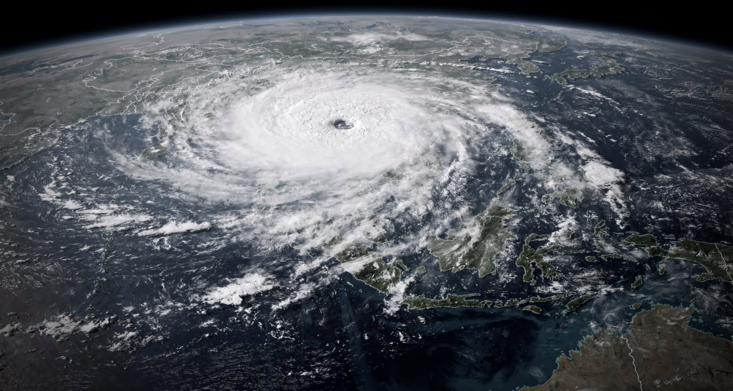
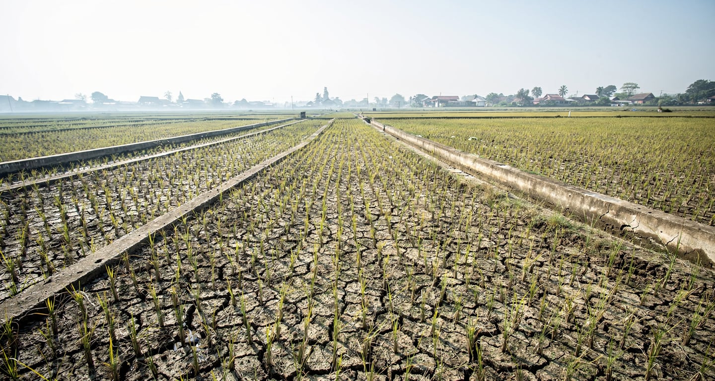
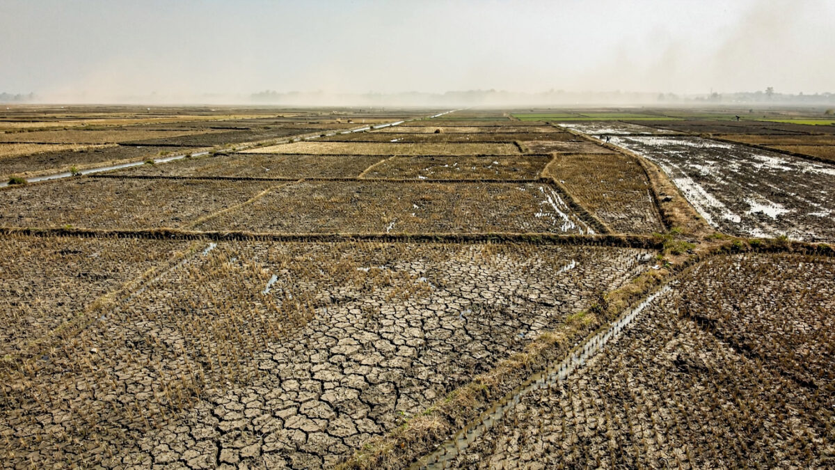
El Niño is the warm phase of the El Niño Southern Oscillation, a recurring pattern that releases ocean heat into the atmosphere and tilts rainfall away from some regions and onto others. Events typically last 9 to 12 months. A “super” event simply means an unusually strong one, with sharper effects on drought, heat and rainfall.
The agencies watching it — NOAA, the ECMWF, and Australia’s Bureau of Meteorology — are still in forecast territory. The certainty lies elsewhere. Every fraction of a degree on the baseline already intensifies heatwaves, extreme rainfall and droughts before any El Niño is confirmed.
The forecast is uncertain — the baseline is not
The cleanest fact in this story is the climate backdrop. The WMO outlook, reported through a United Nations University briefing, projects the 2025–2029 mean at 1.2°C to 1.9°C above pre-industrial levels, with a 70% chance the five-year average tops the 1.5°C threshold. That is a decadal projection, not an El Niño forecast — and the distinction matters.
Here is the mechanism that links the two. A strong El Niño releases stored Pacific heat, producing a temporary spike on top of the existing baseline. When the baseline is already elevated, a short-lived regional shock is more likely to spill into food, water and energy systems at once.
This is the part worth stating plainly: the danger is not the El Niño alone, but the warmth it would compound.
The honest limit is in the forecast itself. The specific agency probabilities widely attached to this event — the headline percentages for strength and continuation — are not yet confirmed by directly sourced NOAA, ECMWF or Bureau of Meteorology data here, and should be read as a high-risk watch rather than a settled strong-event signal. The full WMO climate update is available through the World Meteorological Organization.
A warmer baseline turns anomalies into synchronised shocks
The reason a 70% chance of breaching 1.5°C across 2025–2029 is not a distant abstraction is what it implies for timing. It describes a multi-year state in which any strong El Niño lands on already-elevated global heat. The shock does not start from zero.
The policy gap sharpens the exposure. The Glasgow Climate Pact committed wealthy nations to double adaptation finance for developing countries — the drought and flood preparedness that is the first-line defence against an El Niño. Yet the UN reports most climate finance still flows to mitigation rather than resilience. Food systems and disaster agencies enter a severe event underfunded.
That is the structural fact beneath the forecast: the regions most exposed to the next strong event are the ones least equipped to absorb it.
Beyond the headline
The bigger picture
This forecast is best read as a stress test of the post-Paris climate system, not a one-off weather event. A strong El Niño arriving inside a warmer baseline can turn what used to be regional anomalies into synchronised shocks across agriculture, energy demand and disaster response capacity.
The human cost
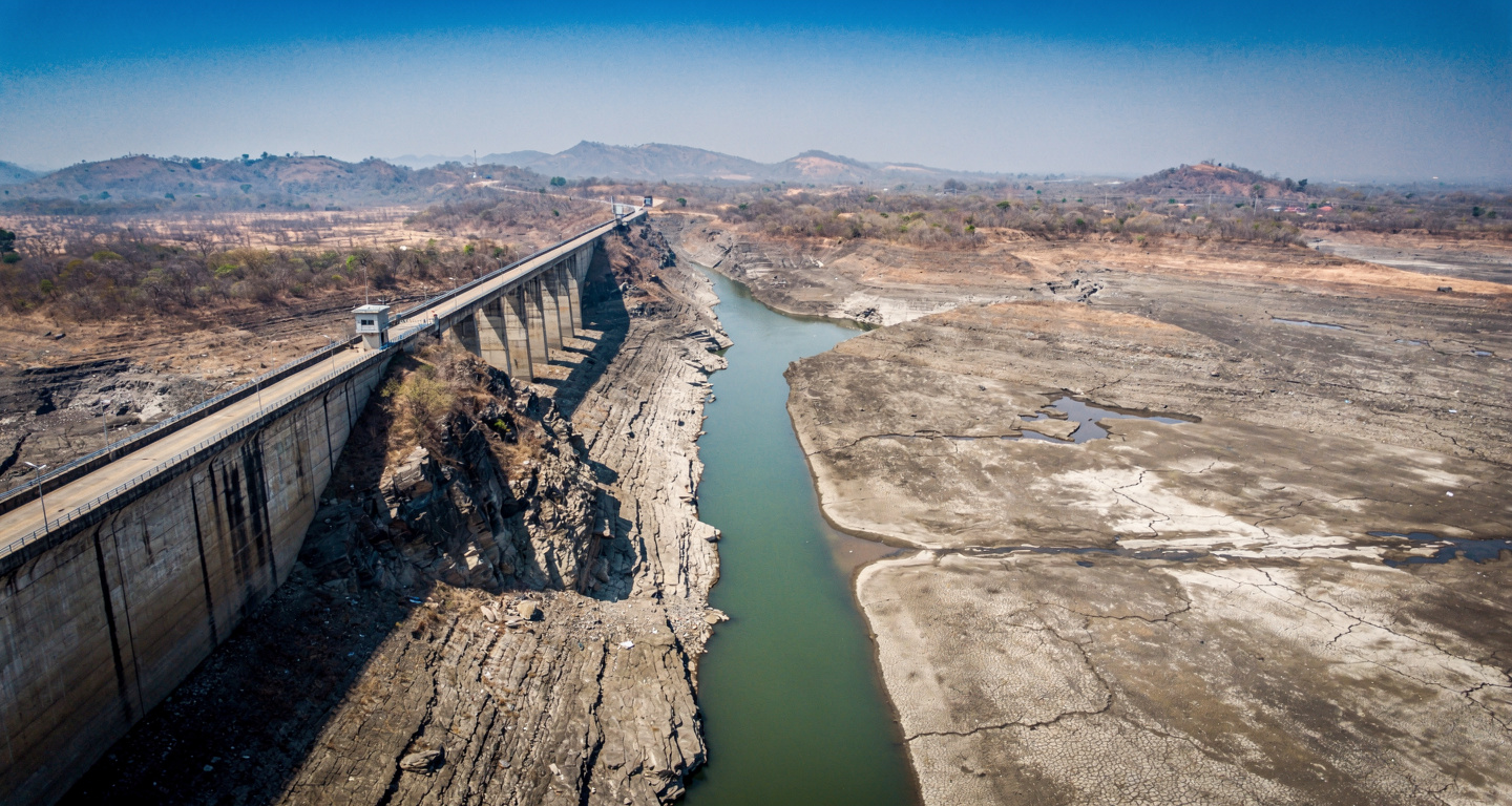
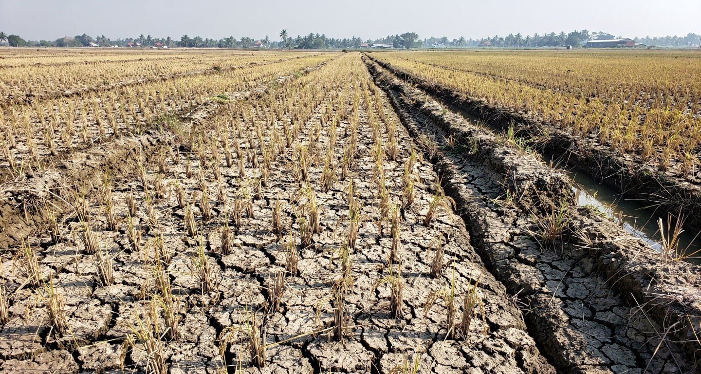
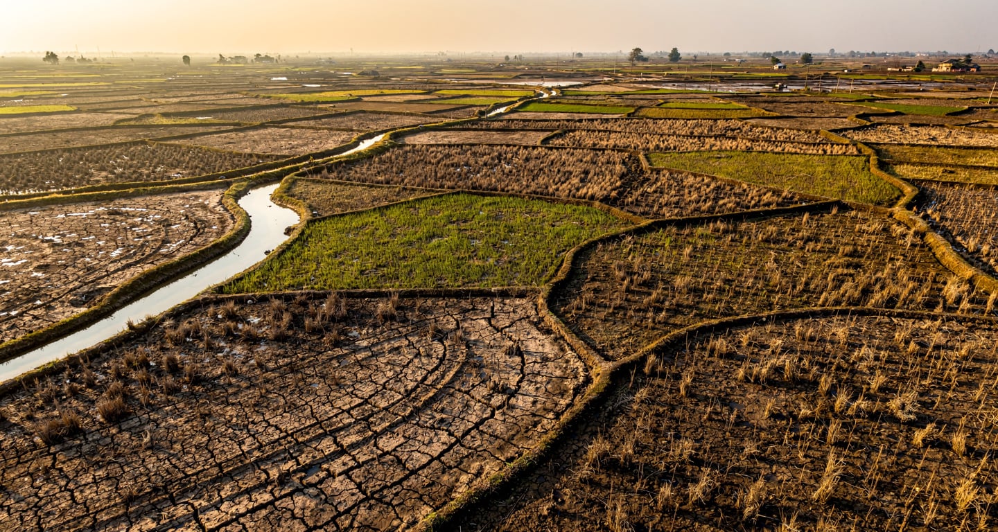
The first people to feel the damage are not global markets but households in drought- and flood-exposed regions that depend on one or two harvests a year. When rainfall patterns flip, the loss is immediate: fewer crops, thinner incomes, and less room for governments to absorb price spikes without rationing aid.
The reach
For the food-trading sector, the key mechanism is volatility in grain and edible-oil supply from several climate-sensitive exporters at once. The non-obvious implication is that even a forecast-centred story can surface in Western inflation data before any headline weather disaster reaches Europe or North America.
What to track before the forecast firms up
With the event still a high-risk watch rather than a confirmed strong signal, the practical task is monitoring the right indicators and the right exposures.
- Western consumers and households
You may see this in grain and cooking-oil prices before any disaster reaches the news. Watch food-commodity benchmarks through late 2026, when several climate-sensitive exporters could face supply pressure at the same time.
- Supply chain and procurement teams
The risk is not a single failed harvest but simultaneous disruption across multiple regions. Map your exposure to drought- and flood-prone exporters now, and treat the next NOAA and Bureau of Meteorology seasonal outlooks as your decision triggers, not background reading.
- Aid and development funders
The first-line defence is adaptation finance, and the UN says it remains underfunded relative to mitigation. Pre-positioning resources in South Asian and African disaster agencies before an event materialises is cheaper than the emergency logistics that follow it.
Explainer
- El Niño Southern Oscillation
- A recurring climate pattern driven by temperature shifts between the ocean and atmosphere in the equatorial Pacific, with El Niño as its warm phase. Events typically last 9 to 12 months and recur every few years, releasing ocean heat that produces a temporary spike in global average temperature. In a year when the climate baseline already runs near 1.5°C, that spike stacks on top of existing warmth rather than starting from neutral.
- World Meteorological Organization
- The United Nations agency responsible for coordinating global weather, climate and water monitoring across national meteorological services. Its Global Annual to Decadal Climate Update is the reference outlook that places multi-year temperature ranges against the 1850–1900 pre-industrial baseline. The next edition will signal whether the 2025–2029 period stays primed for amplified El Niño impacts or eases.
- Glasgow Climate Pact
- The 2021 agreement reached at the COP26 summit that, among other commitments, called on wealthy nations to double adaptation finance for developing countries. Adaptation finance funds the drought and flood preparedness that is the first defence against an El Niño shock. The UN reports most climate finance still flows to mitigation, leaving the resilience side of the ledger short ahead of any severe event.
RELATED STORIES